Resumen
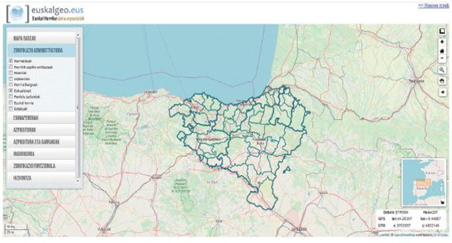
El portal http://www.euskalgeo.eus es una IDE transfronteriza que tiene como objetivo servir los datos geoespaciales relativos a Euskal Herria. El proyecto nace de la mano de GAINDEGIA, el observatorio para el desarrollo socio-económico de Euskal Herria. Los objetivos de la IDE son servir los datos espaciales relativos a Euskal Herria en formatos estándares, facilitando de esta manera recursos para investigaciones transfronterizas y fomentando de esta manera el conocimiento geográfico sobre Euskal Herria. Este servicio se dirige principalmente a investigadores, docentes y periodistas. Actualmente, sirve 48 capas divididas en siete categorías,
la mayoría de ellas centradas en las divisiones administrativas y funcionales. En cuanto a la parte tecnológica, el portal Euskalgeo ha sido desarrollado con el servidores de mapas GeoServer, el servidor de metadatos GeoNetwork y con PotsgreSQL+PostGIS como motor de servidor de base de datos además de la librería Leaflet.js para visualización. Finalmente, la puesta en marcha de la plataforma ha venido acompañada de una estrategia de formación y comunicación, con el objetivo de acercar e impulsar el análisis espacial en las investigaciones que se realicen sobre el territorio que abarca la IDE, así como de interactuar con los usuarios.
Palabras clave: Infraestructura de Datos Espaciales, IDE, Euskal Herria, Euskalgeo, Gislan, transfronteriza, SIG.
Abstract
The internet portal http://www.euskalgeo.eus is a cross-border SDI. Its main objective is to provide geospatial data relating to Basque Country. This project has been performed by Gaindegia, the Observatory for social and economic development of the Basque Country. The SDI serve geospatial data about Basque Country using different standardized formats. The project promotes two key aspects: it makes information available for transborder researches on the one hand, and it promotes knowledge about the Basque Country on the other. This service is aimed at researchers, teachers and journalists. Currently, there are 48 layers available divided in seven different
categories, most of them focusing on administrative and functional boundaries. Concerning the technological aspect, the internet portal Euskalgeo has been developed with the map server GeoServer, the metadata server GeoNetwork and the database management
system PotsgreSQL+PostGIS. The visualization has been carried out using the library Leaflet.js. Finally, the implementation of the internet platform has been accompanied by a formation and communication strategy aiming to support the spatial analyses in the research developed in the territory covered by the SDI as well as interact with users.
Keywords: Spatial Data Infrastucture, SDI, Euskal Herri, Basque Country, Euskalgeo, Gislan, cross-border, GIS.
Autores

Be the first to comment