Resumen
La Infraestructura Interactiva de Datos Espaciales de las Azores (IDEiA) tiene como objetivo promover el intercambio de información geográfica sobre las Azores entre los diferentes organismos encargados de la producción de Información Geográfica. Esos organismos integran los grupos de trabajo temáticos regionales, que fueron creados para analizar e implementar las especificaciones técnicas resultantes de la Directiva INSPIRE.
En las Azores, la armonización de los conjuntos de datos espaciales se está realizando utilizando la herramienta Humboldt Alignment Editor y el modelo de datos INSPIRE desarrollado para la Región. Los grupos de trabajo también están trabajando en la publicación de servicios de visualización y descarga de acuerdo con los estándares de OGC.
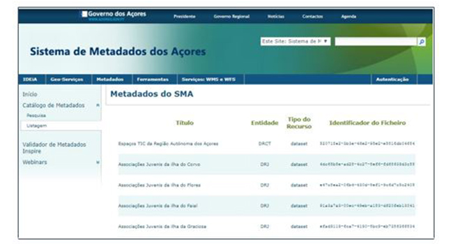
Los archivos de metadatos también se crearon utilizando el Azorean Metadata Manager (GeMA), que es una herramienta multifuncional que permite la producción y edición de archivos de metadatos de conformidad con las reglas INSPIRE y el perfil de metadatos portugués.
Debido al trabajo que se está llevando a cabo, se observa que las Azores han desempeñado un papel importante en el monitoreo de la implementación de INSPIRE en Portugal, contribuyendo también a la presentación de resultados positivos para los indicadores relacionados con la existencia y conformidad de los conjuntos de datos espaciales y los archivos de metadatos de servicios y la accesibilidad a ellos a través de servicios de descubrimiento.
Palabras clave: INSPIRE, conjunto de datos espaciales, servicios, metadato, monitorización, IDEiA, GeMA, Azores, Portugal.
Abstract
The Interactive Spatial Data Infrastructure of the Azores (IDEiA) aims to promote the sharing of geographic information about the Azores between the various entities responsible for the production of Geographic Information. Those entities integrate the regional thematic working groups, which were created to analyze and implement the technical specifications resulting from the INSPIRE Directive.
In the Azores, the harmonization of spatial data sets is being made using the Humboldt Alignment Editor tool and the INSPIRE data model developed for the Region. The working groups are also working on the publication of view and download services in accordance to OGC standards.
Metadata files were also created using the Azorean Metadata Manager (GeMA), which is a multifunctional tool that allows the production and edition of metadata files in conformance to the INSPIRE rules as well to the Portuguese Metadata Profile.
Because of the work being carried out, it is noted that the Azores have played an important role in monitoring of the INSPIRE implementation in Portugal, contributing too to the presentation of positive results for the indicators related to the existence and conformity of the spatial data sets and services metadata files and the accessibility to them through discovery services.
Keywords: INSPIRE, spatial data set, services, metadata, monitoring, IDEiA, GeMA, Azores, Portugal.
Autores
Raquel Medeiros
Regional Directorate for the Environment, Government of The Azores
raquel.t.medeiros@azores.gov.pt

Be the first to comment